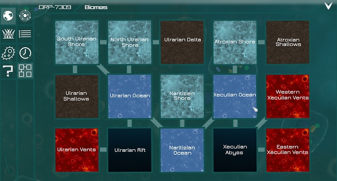
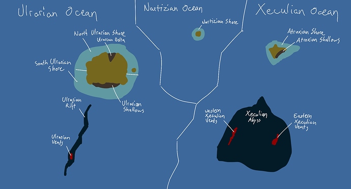
This is an idea worth investigating. Basically you‘re suggesting something between what I proposed and what TJ proposed in his old thread. If I understand you correctly this system could in earlier releases stand on its own, the game would just generate a grid of biomes. In (much) later releases that feature an actual heightmap of the planet the game could check which biomes have a border to one another and create a grid based on this information. I made an exapamle of such a grid and the schematic map that this grid would be based on:
This approach, however, poses some problems:
- There could be arrangements which would be very impractical to display on a square-based grid, for example if one biome borders to 20 others (Am I wrong in the assumption that there will be that many biomes? Are we talking about 10 or 1000 biomes per planet?)
- If we have a grid without a map it is equally probable for a species to either of it‘s neighbouring biomes. To make an example on my map sketch: If a species lives in the Ulrarian Rift, its chances of randomly ending up in the Ulrarian Ocean are much higher than its chances to end up in the Ulrarian Vents since the border between rift and ocean is way larger than the border between rift and vents. How are we going to represent that difference? (Am I losing myself in details btw?)
A large benefit of this grid „map“ would be that biomes that are on top of one another could be represented more easily. The ocean surface biome is linked to the twilight zone, which in turn is linked to the deep ocean.
All of this feels quiet speculative at the moment. I don‘t even think it‘s clear yet how exactly biomes will be implemented (exept for the various nice backgrounds, which are already in the game.)

