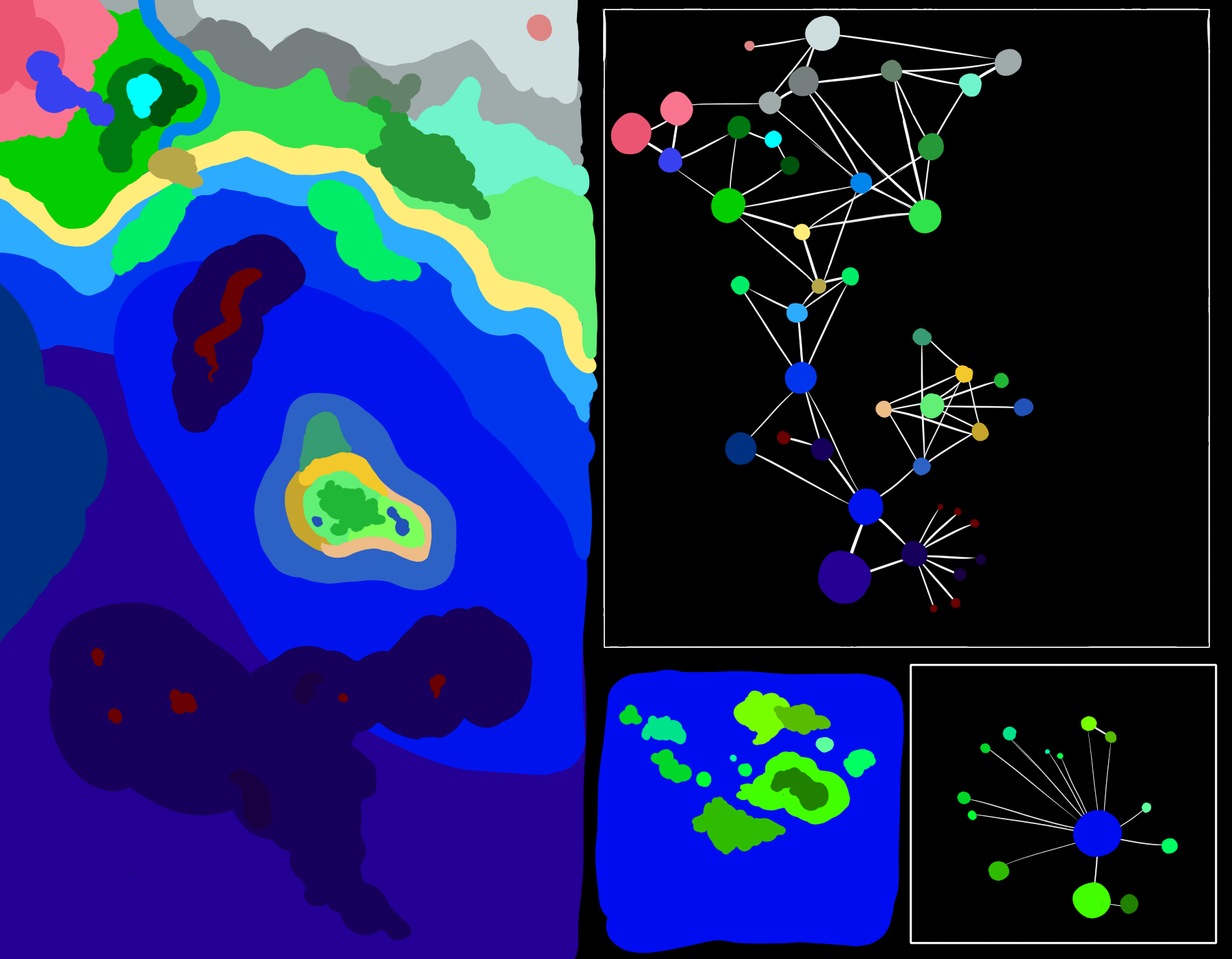
Here’s a quick node map based on a quick landscape I did, showing lots of interconnected biomes, and below that, an example of how a patch can have well over 8 neighbors.
Why should it split in half? I imagine, based on how well and how quickly your new species can compete with your old one, you could end up with a population larger or smaller than theirs, or your population can flourish alongside theirs without decreasing it very much. Splitting it in half kinda feels like an unrealistic and gamey representation of a pretty important game mechanic. I suppose it might work until we have a way to properly determine that sort of stuff, though.
I definitely like the idea of you being the first and only cell to evolve a nucleus. A while ago I did mention the idea of there being a really rare chance for another cell to evolve it as well, so your planet would have two completely separate lineages of eukaryotes (though I feel there’d have to be a significant difference in the nucleus and its effects for that to be any meaningful)
That looks really nice. I’m a bit worried about giving the player geographical information in the microbe stage because I think we want to reveal that later, with voyages of exploration and satellites. For example in this image can you see where the continents are? If I told you light blue was coastal can you see them now? And that’s without connecting lines or knowing what the dots mean.
Moreover does the player need this geographical information? If they are moving from abyss to ocean does it matter if that’s north or south or 5 miles or 500 miles?
I wasn’t suggesting that the geographical map be displayed, I was just showing it alongside the node map to give you an idea of how a node map based on it would look. I can see that the location of the continents is somewhat apparent in my map, but that’s probably just because of the way I drew it. A computer-generated one would probably look more random. You could still tell there are continents - even without terrestrial biomes included, there’s still the shallow ocean biome which usually suggests a nearby landmass, but their sizes, shapes, and locations shouldn’t be correct.
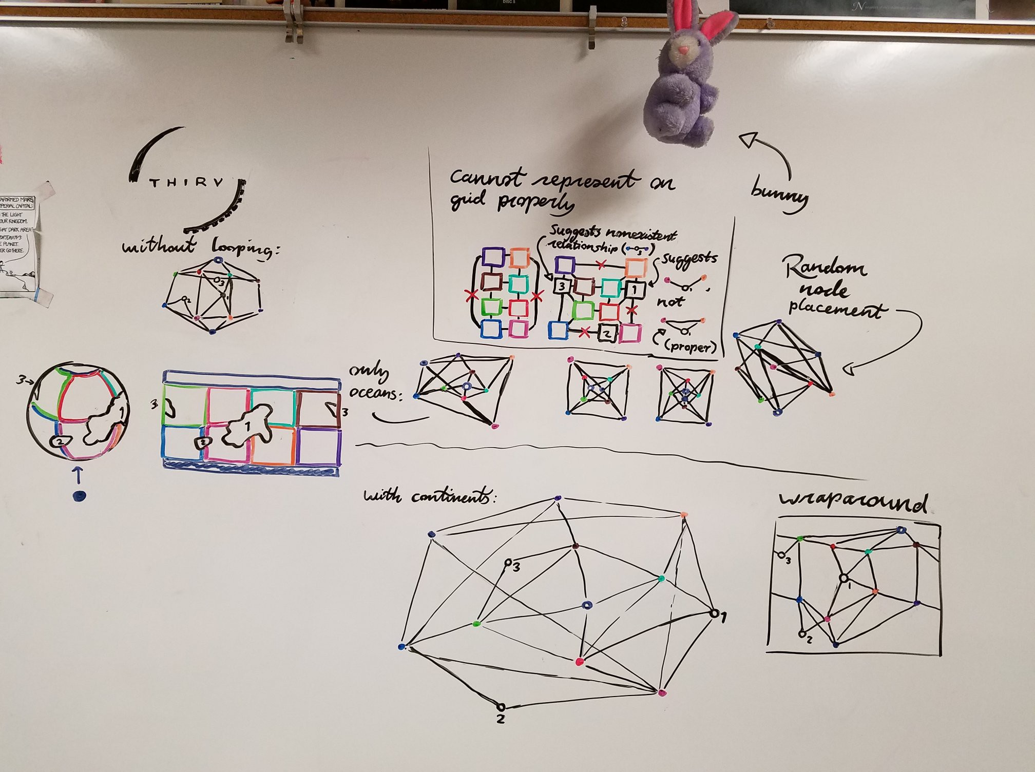
Did a quick drawing on my whiteboard, trying to figure out how nodes (and grids) could handle maps that loop around (e.g, planets). The nodes ended up a little messy sometimes, (I like how the big map at the bottom middle looks though), and I couldn’t get a grid to handle it at all. In the bottom right, I also messed around with the idea of node paths being able to wrap around the edge of the frame instead of having to go all the way through the middle.
Apologies if the colors are hard to differentiate
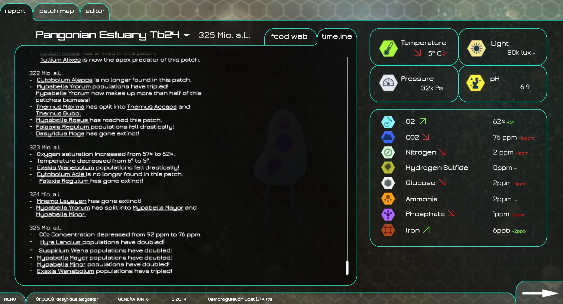
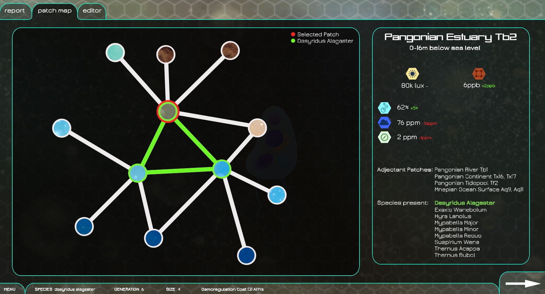
Ok I wanted to summarize where we are at with the patch selection screen / map. What we want is a map screen which shows the patches you can see and how they are connected. It lets you split your species if you wish and send some to a new patch. It should probably also have some climate data for each patch (energy available, light levels etc) however this could be on a different screen. Maybe also it needs info on which species are in which patch, however this could be a different screen too.
We’ve talked about having a node and line style to it which I am ok with, I’m open to other ideas if people have them.
We’ve also talked about whether to have the map be side on or top down, here are my thoughts on that:
Side on: patches which are deep in the ocean are the bottom of the screen and ones which are shallow at the top, northerly latitudes are at the left and southerly to the right. This is cool because depth is a large part of the microbe stage, it determines how much light a patch gets and how much debris falls down to it. Also whether it is on the ocean floor is quite important. It also doesn’t give away much geographical information about the planet.
The drawbacks with this are that it probably won’t work for later stages. I can imagine a screen with land and sea patches all side on but it might be a bit odd, changing map styles between stages is not ideal though possible. It also doesn’t really allow for wrapping the patch map around the planet however I am not sure if that is important.
top down: it works just like a normal map. This is cool because it’s easy to understand and can work easily for all stages. It’s easier to wrap around the planet if that is desirable.
With this though I really don’t want to generate a planet map and show that to the player at any point before they are discovering it with Columbus style expeditions in the strategy stages. So we can generate a top down 2d map for the microbe and creature stages which has the right proportions of patches but which is jumbled up, though this might be confusing.
Moreover it’s a bit more complicated to communicate depth and light levels etc however this shouldn’t be so bad with colours and labels.
Does anyone have opinions or preferences about this? I think I’m slightly in favour of side on but I don’t mind too much.
I like side on but I realize we need to still think about later stages when making these sorts of descisions. Maybe side on then we take that map and “convert” it when you get to the next stage.
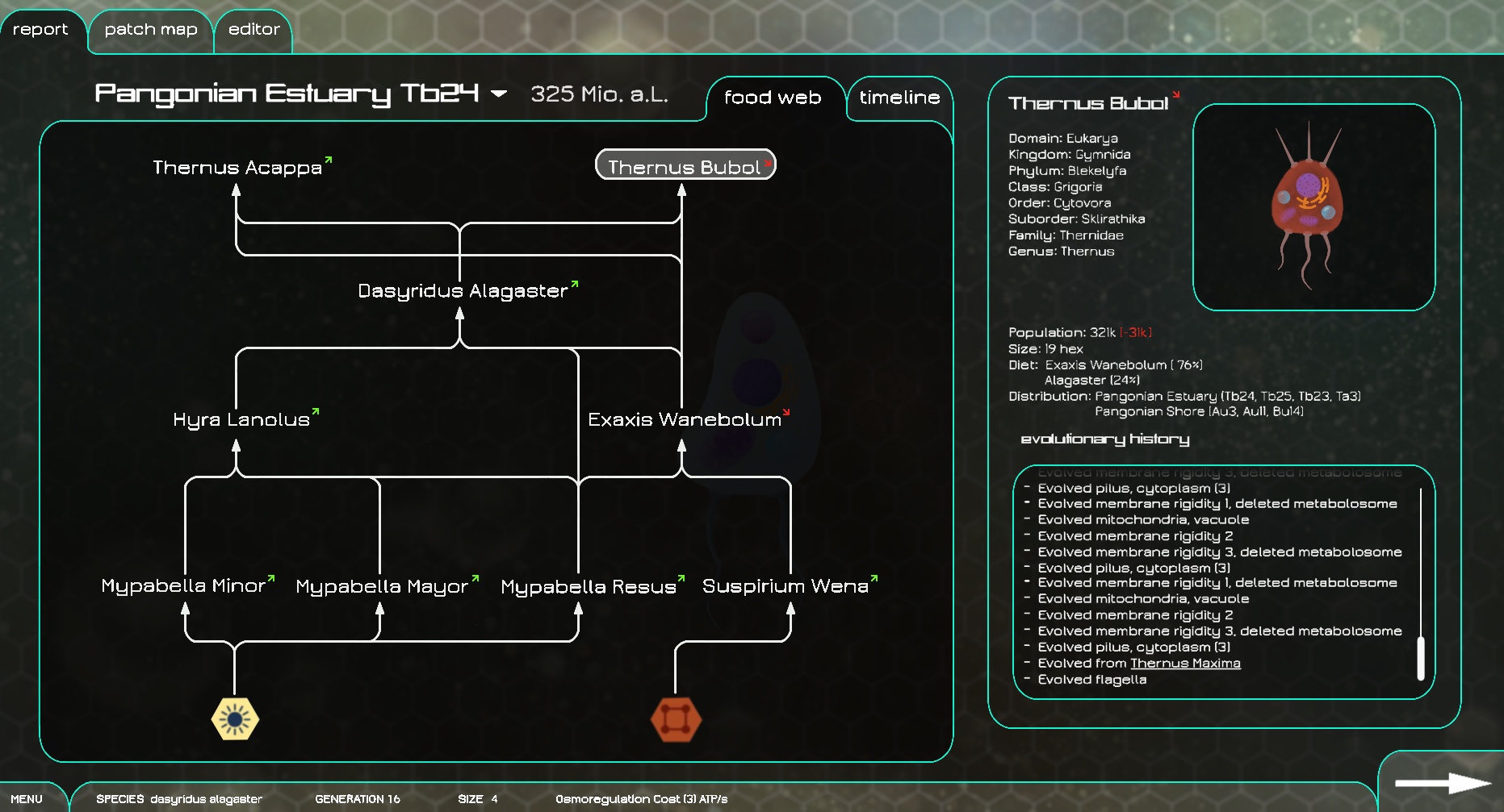
I just thought I could post this here so it doesn‘t get lost in the discord feed. It‘s basically the same in-game encyclopedia, just within the editor session.